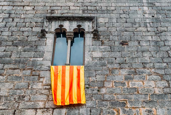
Throughout history, the concept of a border has been subject to multiple interpretations. For the Romans, borders were conceived as a zone of influence and control rather than fixed lines. In contrast, in medieval times, a border was a dynamic, flexible space, often laden with commercial and political opportunities. However, from the mid-17th century onward, the Pyrenean border became a legal line of separation between territories, acquiring a distinctly administrative character.
This new border conception had profound consequences for the political configuration of Europe. The reorganization of the political map favoured the consolidation of new state sovereignties but also led to the rupture of cultural, social, political, and economic realities that had been cohesive for centuries. Thus, any person, community, or territory that challenged this new principle of sovereignty—in the absolute and indivisible unity of the State—faced harsh military and political reprisals.
Following this evolution, the concept of a border has been widely analysed by various disciplines in the social sciences. Until recently, these studies were influenced by political-historical perspectives that interpreted the border as a fundamental element for defining states. Examples of this can be found in 19th- and 20th-century political theories, which justified the precise delineation of territory and the strategic use of borders as instruments of defence and state sovereignty. Over time, politics allowed the state to associate its identity with the concept of a nation, thus forcing the unification of diverse historical realities under the nation-state model, a process that ultimately generated internal tensions.
However, more recent studies in historical geography have redefined the notion of a border. It has been demonstrated that borders are not simple, immovable physical lines but dynamic contact spaces where constant social, economic, and cultural interactions occur. This perspective dismantles the traditional idea of a border as an impenetrable wall and redefines it as a transition and relationship zone. A paradigmatic example of this new perspective is the doctoral thesis of Oscar Jané Checa, which provides a rigorous and well-documented analysis of the construction of the Pyrenean border in the 17th century and its impact on Catalonia. Studies like this help to understand that the border is not just an imposed division, but also a living space that shapes and transforms the societies that inhabit it.
Geographical elements that shape an identity
The origins of the Països Catalans date back to the Carolingian era when, under the policy of ‘Renovatio Imperii’, the territories south of the Pyrenees—from Pamplona to Barcelona—were organized into defensive territories against the Andalusian world. Until the 13th century, the Counts of Barcelona maintained interests north of the Pyrenees, but after the Battle of Muret, expansion was redirected toward the southern peninsula and the eastern islands, shaping what we know today as Països Catalans. This process was made possible by three fundamental geopolitical elements.
The first key factor was the sea, understood as the main axis of communication and territorial cohesion. This allowed the establishment of a wealth triangle between Valencia, Mallorca, and Barcelona—a model that, despite centralist pressures, persists today as an economic and cultural reference.
The second determining factor was the difference in altitude between the Castilian plateau and the Mediterranean coastline. The physical structure of Països Catalans has favoured, since ancient times, a high population density in coastal areas and low valleys, in contrast to the higher and more isolated inland regions. This geographical reality has led to different population models: a coast open to communications and exchange, while the interior has maintained a more dispersed and self-sufficient population.
This distribution can be observed in a night map of the Iberian Peninsula, where the most illuminated areas correspond to the Ebro Valley -Zaragoza-, the Mediterranean coast -from the Roussillon plain to Murcia-, the Guadalquivir Valley, the mouth of the Tagus River, the small valleys of the Cantabrian coast and the centre of the peninsula, as it is the capital. The rest of the territory remains in the dark, indicating a low demographic density that reflects the reality of empty Spain.
The third key factor is the presence of a vast demographic desert known as the Celtiberian Mountain Range. This area, with an extremely low population density, has historically remained disconnected from other peninsular regions. It is the second least populated area in Europe, after Finnish Lapland. This desert extends from Tortosa to the north with Zaragoza, to the west with Madrid and to the south with Ciudad Real. This population vacuum has acted over the centuries as a natural barrier that has preserved the Països Catalans from direct contact with the peninsular interior, reinforcing its geopolitical uniqueness.
This physical separation has also been reproduced in the north, where the French noon has similar characteristics, although to a lesser extent. This explains why the Catalan territories of the French State (Roussillon) and the Spanish State have historically lived isolated from each other. Only some accesses, such as the Ebro Valley -following the waterway through the Tortosa-Lleida-Zaragoza axis and the Huerta of Alicante, have allowed a certain connection with the interior.
This geopolitical framework, together with the language as a distinctive element, has consolidated the idea of a country with a homogeneous structure and its meaning. Beyond the linguistic unity from Salses to Guardamar, the geographical configuration explains the territorial continuity of the Catalan language, which expanded following a logical path without significant natural obstacles.

“The sea is understood as the main axis of communication and territorial structuring. This made it possible to establish a triangle of wealth between Valencia, Mallorca and Barcelona, a model that – in the face of centralist attacks – persists today as an economic and cultural reference.”
Dynastic rivalries and family clashes
After the Castilian Civil War (1475-1479), the two largest territories of the Iberian Peninsula—the Kingdom of Castile and the Catalan-Aragonese Confederation—formed a new political entity known as the Hispanic Monarchy. This dynastic state was structured around two key elements: the army and foreign policy. However, other fundamental aspects of the modern state, such as borders, currency, laws, and institutions, remained completely separate. Initially, the Catalan-Aragonese Confederation maintained its institutions and legal systems, leading to recurring tensions with the Hispanic monarchy in the following centuries.
The discovery of rich metal deposits in Mexico and Peru led to the founding or refounding of American cities that played a strategic territorial role in ensuring a constant flow of wealth to Castile. This transformed Castile into an economically powerful actor but also into a state that spent exorbitant sums to construct its idea of civilization, based on Catholicism. This obsession often led to numerous conflicts of various kinds, such as theological disputes, dynastic struggles, commercial issues, and monumental architectural projects. In addition, at the beginning of the 16th century, the main Communities of Castile were forced to assume a considerable tax to finance the purchase of the imperial title by the Habsburg family, which triggered the famous Revolt of the Commoners.
With the acquisition of the imperial title, France – ruled at that time by the Valois dynasty – perceived the Habsburgs as its main enemy, since with that purchase, the Habsburg family came to control most of the territories surrounding the French kingdom. This situation further aggravated France’s economic challenges in the mid-16th century, as the Habsburgs indirectly conditioned commercial mobility and restricted opportunities for growth.
As a result, key sectors such as agriculture – especially vines, wheat and other cereals – and textile manufacturing, which were the economic engine of the French kingdom, were limited by the difficulties of access to the markets of Italy and the United Provinces. Key cities such as Lyon, Paris and Marseilles experienced the effects of this blockade, and their commercial freedom and capacity for economic expansion were curtailed.
For this reason – despite being an eminently Catholic society – France supported the Dutch and German Protestant factions, to counteract Hispanic expansionism. This strategy was part of the geopolitical principle of the “Grand Dessein”, which sought to surround the Hispanic dominions with hostile allies to wear down the influence of the Habsburgs in Europe. As a consequence, during the following centuries, the Hispanic Monarchy and France would clash fiercely for control of Europe.
Change in European economic dynamics
At the beginning of the 17th century, the American mines began to show signs of depletion, a trend that would become more pronounced as the century progressed. This slowdown in the inflow of precious metals endangered the economy of the Hispanic Monarchy, which -to maintain its high rate of spending – was forced to borrow from German and Genoese banks. This financial dependence led to a generalized increase in taxes and a strong fiscal pressure on the entire Hispanic society. Thus, the monarchy was forced to look for new financing mechanisms, which would lead it to demand greater contributions from the different kingdoms of the Hispanic Monarchy.
In this context, in March 1626, Barcelona received King Philip IV, who had arrived in the city to swear the Catalan constitutions. However, the real purpose of the visit was to unblock the ambitious plan of the king’s minister, the Count-Duke of Olivares. The project, known as the “Union of Arms”, intended that each kingdom of the Hispanic Monarchy, including the Catalan-Aragonese Confederation, would contribute a determined number of money and soldiers, a burden that until then had fallen mainly on Castile since it had the exclusive monopoly of the American precious metals.
However, the Castilian oligarchies did not gauge well the implications of the oath of the Catalan constitutions. While it granted Philip IV the title of Count of Barcelona, it also restricted his ability to freely dispose of Catalonia’s economic resources. This meant that the monarch needed the consent of the Diputació del General and Les Corts to obtain new taxes or request extraordinary resources, which considerably limited the monarchy’s ability to execute Olivares’ project.
During that visit, the Catalan institutions showed the king more interest in the resolution of grievances that they considered essential than in contributing to military conflicts of exclusively monarchical interest. Among these demands were the demand to block the interference of the Council of Castile in the affairs of the Principality -initiated in the time of Philip II- the protection of Catalan trade, the limitation of the privileges of the Castilian Mesta and other monopolies that benefited Castile to the detriment of Catalonia, as well as measures to protect Mediterranean trade against piracy and French and Genoese competition. Catalonia never refused to defend herself from possible threats, but she rejected a fiscal and military imposition that violated her legal system.
With no clear options on the horizon and excessively conditioned by its international policy, the Hispanic Monarchy ended up imposing a forced militarization and an increase in fiscal pressure -without prior negotiation- with the Catalan institutions, which further fuelled the tension between the central government and Catalonia. This situation of unrest was perceived by the French monarchy as an opportunity to weaken the Hispanic power in the Iberian Peninsula. For decades, France had been looking for fissures in the Hispanic Monarchy,and the situation in Catalonia provided the ideal pretext to intervene.
The opportunity presented itself in 1639 when the Catalan social and institutional crisis became fertile ground for insurrection. France acted with a calculated strategy of destabilization, based on three main axes. First, it offered diplomatic and political support to Catalonia by recognizing its sovereignty under French protection. Second, it intervened militarily in Roussillon and other Catalan areas, reinforcing the perception that France could be an ally against Castile. Finally, it fostered internal division in Catalonia, playing on the rivalry between supporters of resistance and those who saw an alliance with Paris as a viable political option. With these moves, France managed to weaken the Hispanic presence and position itself as a key player in the Catalan conflict.
“The Catalan institutions showed the king more interest in the resolution of grievances that they considered essential than in contributing to military conflicts of exclusively monarchical interest.”
Conflict of identities
Faced with the repression of Philip IV and the centralizing policy of the Habsburgs—led by the Count-Duke of Olivares—Catalonia proclaimed Louis XIII as Count of Barcelona in 1641. This decision implied a reformulation of the Catalan identity discourse, situated between defending its institutions and the necessity of a strategic alliance with France.
However, this connection with France was not homogeneous or without tensions. The French presence in Catalonia did not lead to full integration within the French monarchy, but instead generated discontent among various sectors of society. As French military support transformed into an actual occupation, disenchantment toward France grew, ultimately favouring Catalonia’s return under Castilian sovereignty in 1652.
Oscar Jané Checa’s thesis shows that the redefinition of identities did not only take place in Catalonia, but also in France and Castile. For Castile, Catalonia was becoming – and still is today – a rebellious region that questioned the imperial project of the Habsburgs. For France, northeastern Catalonia was a territory that could become a frontier territory to be administered and assimilated. And Catalonia -as always-was oscillating between the defence of its institutions and the need to fit somehow between one of the two neighbouring monarchies.
At the same time, the financial situation of the Hispanic Monarchy deteriorated. Faced with the inability to meet its debts, the State entered into a cycle of successive bankruptcies (1627, 1647, 1652 and 1662), which undermined its credibility in the eyes of European chancelleries and weakened its international position. On the other hand, France began to apply colbertism, a form of mercantilism that encouraged industry, luxury manufacturing and navigation, making it in a short time the great European economic power of Louis XIV’s time.
A morning on Pheasant Island
On November 7, 1659, Pheasant Island, a small river islet at the mouth of the Bidasoa River between Hendaye and Irún, became the setting for a crucial moment in European history: the signing of the Treaty of the Pyrenees. This agreement ended the long war between the Hispanic and French monarchies, a conflict that began in 1635 as part of the Thirty Years’ War.
Pheasant Island, due to its strategic location as a neutral territory, was chosen for the negotiations. On one side, Luis de Haro, representing a war-weary Hispanic monarchy in decline, and on the other, Jules Mazarin, the powerful prime minister of Louis XIV, advocated for an ascendant France, consolidated as an emerging power in Europe.
France, moreover, arrived with its homework done. For months, the jurist, historian and ecclesiastic Pierre de Marca, royal commissioner, had been working on the delimitation of the new border between the Kingdom of France and the Hispanic Monarchy, especially concerning the incorporation of Roussillon and Cerdanya. His posthumous work, “Marca Hispánica” (1688), became a fundamental reference in the study of the Pyrenean border and the construction of the French territorial identity. Although he was neither a geographer nor a cartographer, his influence on the political configuration of the territory made him a key figure in 17th-century geopolitics.
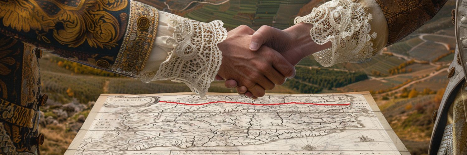
When the pens met the paper, the cession of several strongholds and territories that reconfigured the political reality of the Iberian Peninsula was confirmed. Castile ceded to France the counties of Roussillon, Conflent, Vallespir and part of Cerdanya, thus consolidating the division of Catalonia. At the same time, the treaty stipulated the marriage of Maria Teresa of Austria, Infanta of Castile, to Louis XIV of France, a dynastic bond that was intended to seal the peace through family union.
While notaries and witnesses were certifying the agreement, celebrations were being prepared in Madrid and Paris. However, for the inhabitants of the affected regions, especially in Catalonia, the signing of this treaty represented a deep wound. And more than forty years would have to pass before the Hispanic Monarchy officially notified the Generalitat of the cession of those territories. The new Pyrenean border represented a definitive cut in the historical territory and at the same time a breach that would ignite, decades later, the War of the Spanish Succession (1701-1715). This conflict, with tragic consequences for the Catalan-Aragonese Confederation, would end up establishing the Bourbon model in the Iberian Peninsula, irreversibly altering the political and national balance of the region.
“For Castile, Catalonia was becoming – and still is today – a rebellious region that questioned the imperial project of the Habsburgs. While for France, northeastern Catalonia was a territory that could become a frontier territory that had to be administered and assimilated.”
The economic and institutional fracture of the border
One of the key elements in the integration of Northern Catalonia into the French orbit – apart from the construction of countless forts and fortresses such as Montlluís, Bellegarde, Prats de Molló, Vilafranca del Conflent, Perpinyà, Salsas or Colliure – was taxation, especially through the salt tax, an essential product for preserving food. While in the rest of Catalonia, salt – coming from the mines of Súria and Cardona – continued to be subject to the Hispanic tax system, the new French territories were incorporated into the gabelle regime, a high tax on salt imposed by the French State, which from then on would consume it from the salt mines of Peyriac-de-Mer, Sigean and Gruissan. This change forced the inhabitants of the region to modify their commercial structures and reinforced their economic dependence on the French monarchy.
Consequently, many products that previously circulated freely between the territories north and south of the Pyrenees became subject to taxes and regulations imposed by both monarchies. However, these restrictions generated new commercial dynamics outside state laws. Smuggling became an economic activity of great importance for many border communities, which found in this practice a means of survival and prosperity.
Over the years, this economic fracture was consolidated with a progressive institutional and cultural assimilation. The French administration dismantled the institutions of Roussillon and Cerdanya and progressively imposed the French language in education and official spheres. This process sealed the definitive separation between southern and northern Catalonia, generating a new frontier that transcended geography and became a political and identity fracture that persists today.
A final reflection on the contemporary border
More than three centuries later, the border drawn in the 17th century continues to have significant implications. Northern Catalonia, administratively integrated into the French State, retains cultural and historical traits in common with the rest of the Països Catalans, but its integration into the French Republic has progressively eroded its specificities. The border, which in the past was an administrative and economic barrier, has become today a symbolic separation that marks the distance between two different political and legal realities.
These borders, fixed with the Peace of Westphalia (1648) and reinforced by the Treaty of the Pyrenees (1659), were conceived as impassable lines in a world dominated by nation states. However, this state model is now in crisis. Globalization, European construction and the claims of national identities question the limits set centuries ago. Alejandre Deulofeu, with his theory of “The Mathematics of History”, stated that empires and nations follow predictable cycles of rise and decline, and that the model built in Westphalia of forced state sovereignties is destined to disappear.
In a European context where borders are constantly being redefined, the European Union has allowed for greater territorial permeability, but identity tensions and struggles for self-determination demonstrate that the border is not only a geographical boundary but also a mutable political and historical construct. Just as the 17th century was decisive for the configuration of the modern nation-state, the 21st century poses new challenges regarding sovereignty, national identities and the role of borders in a changing Europe.
11Onze is the community fintech of Catalonia. Open an account by downloading the app El Canut for Android or iOS and join the revolution!